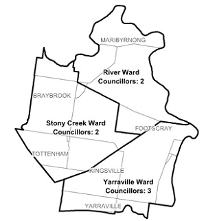
Flood information for the Maribyrnong City Council, encompassing local flood guides and Municipal Flood Emergency Plan.
Note: The Maribyrnong Local Flood Guide is open for consultation until 31 March 2025. Please provide feedabck to ust.nwmetro@ses.vic.gov.au
Maribyrnong Flood History

Communities in the City of Maribyrnong are at risk from riverine and flash flooding events. There
has been a recent increase in population density in Maribyrnong as well as an increase in land use which have increased the flood risk across the council.
This is particularly relevant to Seddon, Yarraville, Braybrook and Maidstone where the ability for water to drain is limited.
The Maribyrnong flood plain is comprised of 400 properties including commercial, residential and community facilities which are threatened by large river events in the order of 1 in 100 year events.
Households and business should refer to their Local Flood Guide or the Maribyrnong City Council Municipal Flood Emergency Plan for more information.
Maribyrnong Township Local Flood Guide
About Flood Guides
Communities can use local flood guides to identify and better understand their local flood risk. They include information about: flood history, how to prepare & respond to fagency and may undertake emergency temporary repairs if required. For minor leaks, superficial damage, removal of debris and cutting down of trees that are still standing, please contact a professional
Contact Information
Local SES Units
- Footscray VICSES Unit:
95 Sunshine Road,
West Footscray.
Municipal Flood and Storm Plan
Municipalities can use Municipal Flood and Storm Plans to prepare, respond and recover from flood and storm events. Maribyrnong MFSEP - Updated December 2021.
This municipal flood and storm management plan is currently being updated. The revised and updated plan will be available soon.


